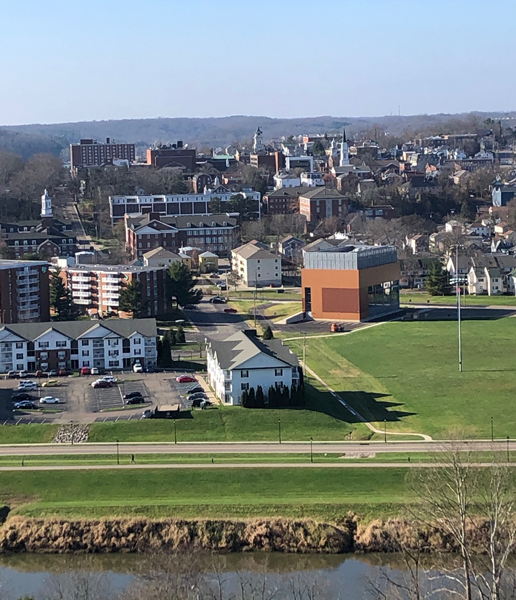
One of the best thing about attending college in Athens, Ohio, is the wealth of outdoor recreation options in the immediate area, plus many more available just a 30- to 45-minute drive away.
You can be chilling out on the sofa in your Athens rental house or apartment, then if the spirit moves you, within 10 minutes be hiking on a trail through classic Appalachian woodlands. Generations of Ohio University students have explored the hills and woods surrounding Athens.
Following are some of the best outdoor recreation options in the Athens area. Many of them are within walking distance of your front door.
The Bike Path
The Hockhocking Adena Bikeway that most OU students and townies know simply as the “bike path” is probably the most popular outdoor recreation option in Athens. However, as we detail in another blog on this site, it extends much farther than just the Athens city limits. The 21-mile path runs from a couple miles east of Athens, through Athens, and then northwest to Nelsonville, and includes several offshoot spurs. One can walk or run a different two- or three-mile stretch of the bike path every day for a week and a half. Also, from the bike path, many hiking trails are available that rise up into the hills. Just be careful not to get lost! If you want a wider view of this amazing, scenic region than just the city of Athens, the bike path is a great start on experiencing it.
Sells Park/Athens Trail Network
Nearly every OU student has visited the retail strip on East State Street, whether to shop at Walmart, Kroger or The Market at State mall, or to eat at one of numerous chain and independent restaurants. But few Bobcats are aware of the vast network of trails that weave up and through the wooded ridges that bracket the north edge of the Hocking Valley along East State Street.
This trail network can be accessed from three main trailheads on the Far East Side of Athens. The main one is located at the 22.5-acre Sells (City) Park, located at the end of Avon Place, off East State Street. Sells Park connects with the Athens Trail Network, a multi-use system of trails that stretch into hundreds of acres of southeast Ohio woodlands, extending into Strouds Run State Park (Dow Lake). Sells Park’s main feature is a small pond located near the trailhead at Avon Place. From Sells Park, hikers also can take the Rock House Trail, a relatively flat trail that skirts the ridges just above East State Street.
A second trailhead is located at the end of a nameless road that extends up the hill, toward the ridge, across East State Street from the Walmart turnoff. The OU Credit Union is on the corner where you turn left, coming from Athens. The Cucumbertree Trail connects with the same network of trails as the Sells Park trail system (including the Rock House Trail), and indeed, you can walk to Sells Park from the Cucumbertree Trail, right along the side of the cliff-sided ridges that stand above the Far East Side. About one-third of a mile from the trailhead is a lovely small pond that’s clearer than many of the green-gunk-covered ponds you’ll find in southeast Ohio. Walk slowly so you can creep up on frogs sunning along the side of the pond. A bit farther and you’ll find an area of cliffs and deadfalls that’s fun to explore. Make sure you know where you’re going or you’re liable to get lost. An occasional sign only provides the bare minimum of information.
A third trailhead, this one specifically for the Athens Trail, can be accessed a short distance up Home Street, far out East State Street before it merges with U.S. Rt. 50. Parking may be difficult to find for this trailhead.
Bong Hill
Many generations of Ohio University students have made the trek up Bong Hill, which overlooks much of Athens, across the Hocking River and freeway from the Mill Street intramural fields. You’ll find a trailhead on Rock Riffle/Long Run Road, on the left and a very short distance from where it runs under the Rt. 50/33 overpass. Many OU students walk to Bong Hill from their residences on the South and East Greens or the nearby student neighborhoods and apartment complexes. They get there by crossing the Stimson Avenue bridge and making an immediate right turn at Rock Riffle Road.
From the top of Bong Hill – named for a popular but illegal activity that generations of OU students have partaken of since the 1960s – you can sit back and enjoy the view, which is especially memorable at sunset. Heading east from Bong Hill are rock formations and cliffs on the south side of the ridge. Be careful not to venture onto posted private property. (There’s another blog on this sit that provides extensive info about Bong Hill.)
The Ridges 1
In the late 1980s, Ohio University orchestrated the transfer of 750 acres of Oho Department of Mental Health lands across the Hocking River from the Convo and West Green to the university. The land, popularly known as The Ridges, is anchored by the old Athens Asylum/Mental Health Center, which moved into new facilities on Athens’ West Side at that time.
The historic asylum buildings remain on The Ridges, with some in use by the university (including the Kennedy Museum of Art). However, both OU students and townspeople alike are more likely to be found hiking and bird-watching on the many miles of trails and gravel lanes that wind through the woods, hills, ravines and pastures of The Ridges. The main destination is typically Radar Hill, from which hikers can obtain a 360-degree view of the Athens area. There’s a number of options for loop hikes on The Ridges property, including two distinct nature trails. Much of The Ridges is also a land lab used by OU science departments. The Ridges is also the home of three old cemeteries where former patients of the Athens Asylum are interred, many of them from the 1800s (including a number of Civil War veterans).
Ridges 2
If you park behind the Dairy Barn Arts Center, along Dairy Lane, you’ll see the Ora Anderson Trail(head), which takes you on a one-mile loop up the ridge and into the hills, with a variety of interesting natural features and an occasional bench to rest on. About midway through your walk, you can wander off the marked trail into high pastures that are part of OU’s Ridges land. At the very top, you can look down on The Summit and Campus Heights apartment complexes.
Strouds Run State Park/Dow Lake
This state park – popularly known as “Strouds” by OU students and townspeople – is the closest one to Athens and rivals any other state park in Ohio. Hiking, camping, picnicking, fishing, swimming, canoeing/kayaking/paddle-boarding (with rentals) – it’s all there for your enjoyment. Go to the park’s website for more information. Strouds Run State Park has an extensive trail system, with one or two connecting with the Athens Trail system.
The Baileys Trail System
This newly opened and yet unfinished trail system is located just outside the village of Chauncey 15 minutes’ drive north of Athens. It’s designed for beginner through expert mountain bikers, though hiking is permitted as well. It runs into the Wayne National Forest and already features many miles of scenic but easily traversed trails. The main trailhead is located on the north edge of Chauncey at the village park, though more trailheads are planned for the future (as well as many more miles of trails). During the web winter months, cycling is prohibited so hikers get the trail system all to themselves.
Baker Preserve
The Baker Preserve is a new hiking area located to the east of Athens, about 3/4 mile north on Ohio Rt. 690 (after you’ve turned onto 690 from U.S. Rt. 50 a few miles east of Athens). You can hike a 2.5-mile loop that’s got a lot of up and down terrain, a couple of creek crossings, and many downed trees across the trail. This trail has several spurs, with one of them intended to join the Athens Trail system at some point in the future.
Many More Outdoor Rec Options
These are just the main outdoor recreation options in the Athens area, though many more are available, especially if you have motor transportation. Within an hour’s drive are the spectacular parks in the Hocking Hill State Park system (including Old Man’s Cave, Cedar Falls and Ash Cave), Burr Oak State Park and Lake Hope State Park, the Waterloo State Wildlife area (near New Marshfield), the Metro Park system surrounding Columbus (including Clear Creek Metro Park, southeast of Lancaster), and in the same area, the Rockbridge State Nature Preserve.